|
|
|||||||||||||
| HOME | :: | WHAT'S NEW | :: | PROJECTS | :: | SAILING | :: | MAINTENANCE | :: | RESOURCES | |||
| SAILING LOGS :: EQUIPMENT AND STORAGE :: MISCELLANY | |||||||||||||
|
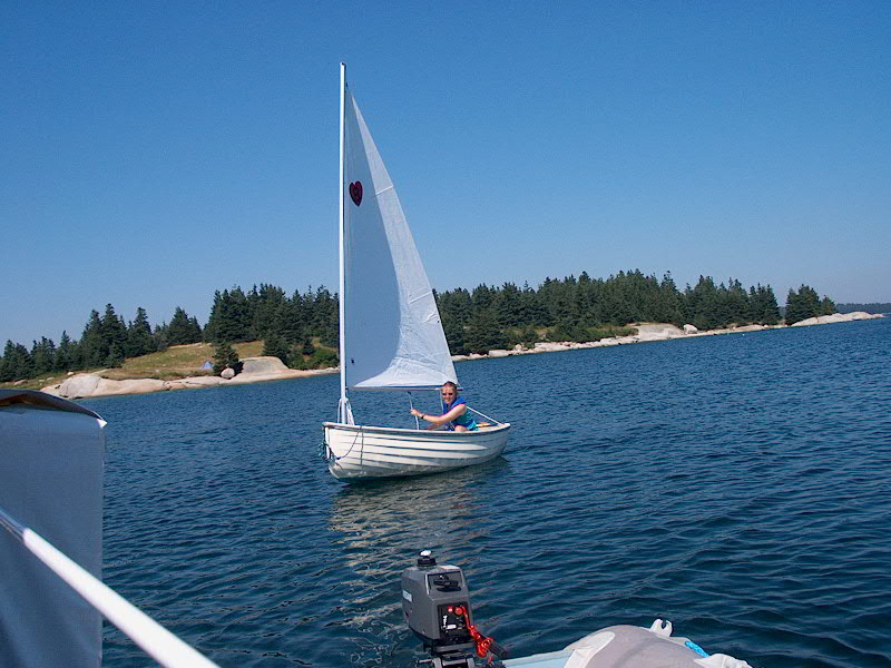
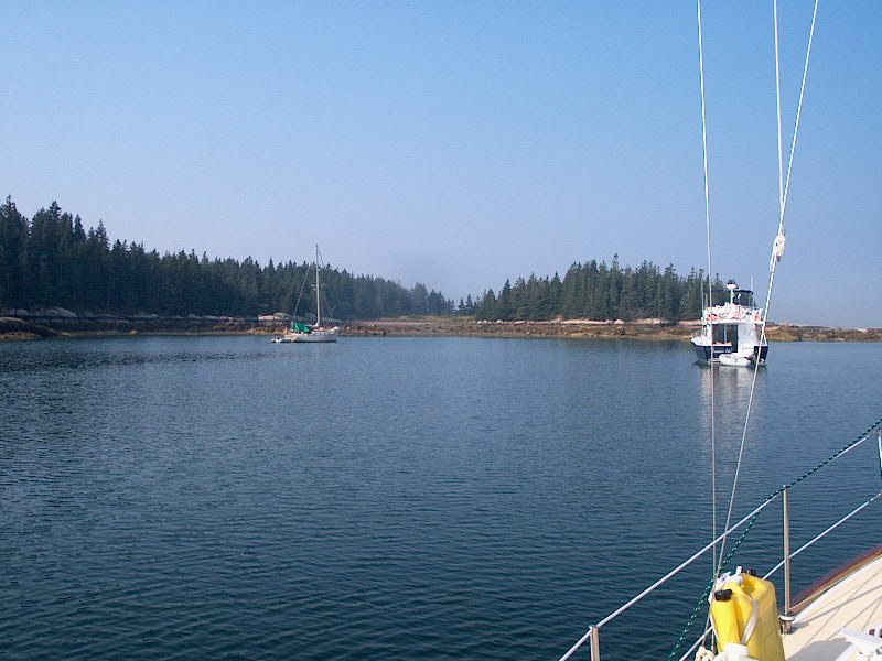
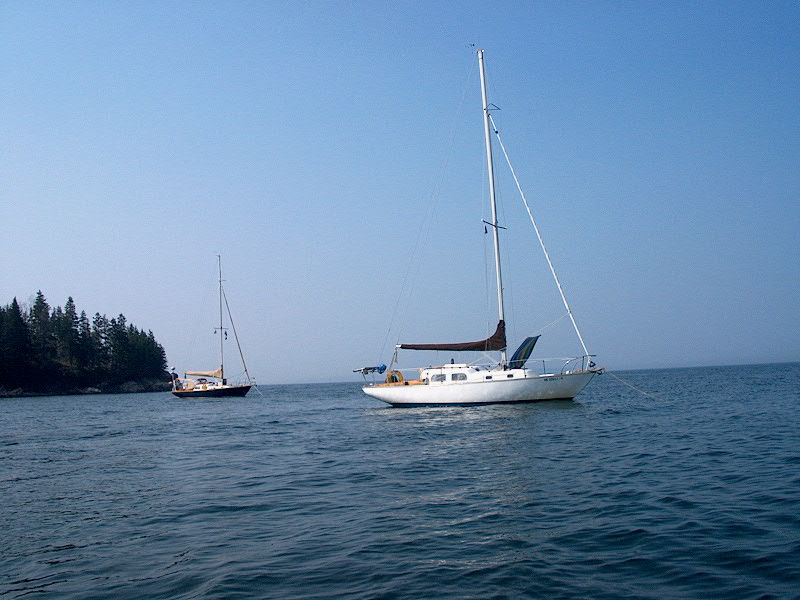
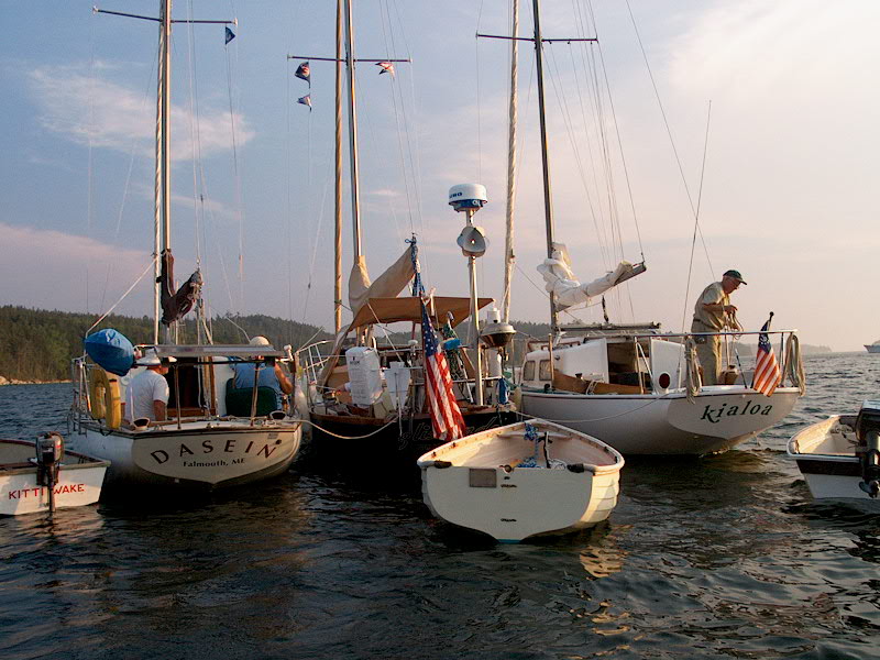
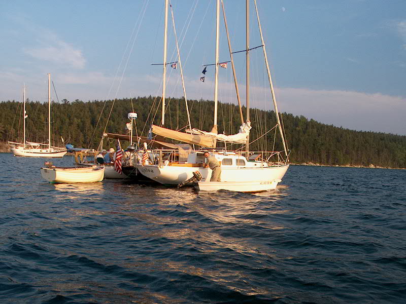
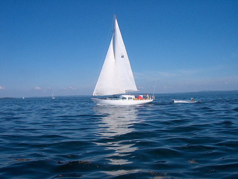
Sunday 8/11: Merchant Harbor Harbor Detail Chart Since we hadn't been planning on arriving here until today anyway, we sort of looked on Saturday as a freebie and decided to stay in Merchant Harbor another day--it is a pretty place, after all. Nathan and I went ashore to Harbor Island in the morning and enjoyed a short hike, and we all adjourned to Glissando for grilled hamburgers at lunchtime before setting up the sailing dinghy for all to try out. The wind was light and very fluky in the harbor, despite the appearance of some heavier winds outside, so sailing was a little frustrating.
A large catamaran came in and anchored close to Dasein, and mentioned to them at that point that they were with the New York Yacht Club and that the annual cruise, all 180 boats, were headed to the many islands of Merchant Row that evening. While we appreciated the heads-up, as far as it went, we objected to this guy's arrogance and unapologetic nature, as he kept repeating how it was "gonna be a parking lot here at 5 o'clock", as if that somehow defended his anchoring too close for comfort. Later, he picked up and moved to a sport very close to and between Dasein and Glissando, saying at that time that he had to make room because he was rafting with someone and , once again, unapologetically as if it were their given right to take over any and all anchorages, however unsuitable, to defend his behavior by telling us how much of a parking lot it was going to be. We thought he reminded us of the band manager in the movie This is Spinal Tap, so we dubbed him Ian (pronounced in the British manner--een) after that character.
I should preface the remainder of this log by saying that the reputation of the New York Yacht Club cruise as a rude, arrogant, and uncaring bunch precedes them, and we had only just been saying a couple days ago how one never wants to get stuck in the same place as one of their planned stops. Now, I'm sure there are many respectable members of the NYYC, and I don't mean to offend any courteous, caring boaters who may belong to this club. But I am sorry to say that there are a few, or perhaps many, members who attend these cruises who are rude, pushy, arrogant, uncaring, and downright despicable--and this generally unsavory behavior was demonstrated to great effect by at least one boat in our anchorage overnight, which I will get to in due course. Their reputation is known by all mere mortal boaters, and I'm sure there are many tales describing their rudeness available through most boating circles. Stereotypes become such for a reason--because of a typical behavior--so the stereotype of a NYYC cruise was not formed in a vacuum. Again, if you're in the NYYC and find my descriptions of your fellow members distasteful, perhaps you should revisit your choice to be a part of it, lest you get wrapped up into the same category, whether uncalled for or not.
Monday 8/12: Merchant Harbor - Wreck Island (Rhumb Line Distance: 1.89 nm) PDF Route Chart Harbor Detail Chart We awoke to thick fog, but with
the sun brightly shining overhead. We had invited Heather and Nathan over
for breakfast, so we enjoyed a leisurely repast through the mid and late
morning. By about 1100, it looked like the fog might be lifting, and most
of the NYYC boats had already left. (YAY!) However, just as soon as
we had this thought, the fog returned with a vengeance, socking u in once again
as heavily as ever. Fortunately, it was short-lived, and by 1245 it had
cleared enough for us to see all the nearby islands, so we raised anchor and
departed. We motored the ridiculously short distance across the channel
and between Wreck and Round Islands to our Heidi was enthusiastic about taking the dinghy for a row, so while I was below making some notes in the written log she prepared to take it out. Suddenly, I heard a splash, and ran above decks to find Heidi, bandana and sunglasses in all, bobbing in the water next to the dinghy; she had lost her balance and fallen! In a high-pitched voice she squeaked that she was fine, so I got out the boarding ladder to help her aboard, dripping wet and embarrassed but otherwise OK.
Tuesday 8/13: Wreck Island - Hell's Half Acre (Rhumb Line Distance: 2.89 nm) PDF Route Chart Harbor Detail Chart Another brutally tough passage today.
After a pleasant trip of 45 minutes or so, we found Billings Marine and tied up at the dock. No blocks, we were told...so we purchased a total of seven bags of cubes, three for us and four for them. The filled their water tank, and we were on our way again within 15 minutes or so, motoring back to Wreck Island via the passage east of Crotch Island, where an active granite quarry exists.
We
arrived back at Wreck Island and Glissando shortly before noon, and preparations
were made for our final departure for the next destination: the narrow
cove in between Bold and Devil Island, which we've been calling Hell's Half Acre
because of the small islands We found a mooring
at the head of the cove that was identical to the one we had picked up at
Pickering Island, so we suggested generously to Dasein that they pick it
up, and we would anchor. Our first anchor set was too close to a rock and
a dock on the nearby island, so we picked up and moved a short distance away and
reset the anchor easily in the mud bottom. After a hot dog lunch in the While we were all ashore, a J/32 came in, with crew standing purposefully on the foredeck with a boathook as if they knew exactly where they were heading--which, of course, it turned out they did: Dasein's mooring, apparently put out by the Mount Desert Yacht Club or some such--the burgee that was on the pickup buoy was the same as the burgee the J/32 was flying. So, unfortunately, at the polite request of the owners of the J-boat, Dasein had to move and reanchor behind us...nice of us to recommend they pick up that mooring, huh. The rest of the afternoon and evening were spent in the strenuous pursuits of cruising, as described throughout other days of this log, with little noteworthy to report, except for the large group of teenagers (well-behaved) who were staying at the small cottage on Bold Island and had a great time buzzing about in their whaler with tubers in tow. What a great spot. In clearer weather ( it was very hazy), Mount Desert would be clearly visible out the mouth of the harbor, framed by Jericho Bay, along with a clean view southwest through the islands of Merchant Row. This is hard to take. Wednesday 8/14: Hell's Half Acre - Butter Island (Rhumb Line Distance: 12.3 nm) PDF Route Chart Harbor Detail Chart With our Triton rendezvous outside Castine coming up on Friday, as well as a generally pressing need for us to provision once again, we decided to hear partway up the bay towards Castine, splitting the difference, more or less. Our loose destination was either Barred Islands or Butter Island--to be determined once we got up a little closer. The day dawned extremely warm and hazy. At first, sitting in the harbor, it was tough to determine whether it was actually foggy or not. (It wasn't...just hazy.) The weather forecast was speaking of 90-degree highs inland, so once again we felt lucky (for so many reasons) to be on the boat instead.
We immediately noticed that there were many boats already at anchor in the small cove, and after a brief drive-about we decided that the anchoring room remaining didn't look so great, so we returned to the beach on the northern side of Butter Island, which is ostensibly protected from the prevailing southerly winds. A couple of boats were anchored there (for the day only, we discovered), so it made our anchoring location less than perfect at the beginning. We both set our anchors simultaneously, but it was soon apparent that the wind was not cooperating and when Glissando finally snubbed her anchor line we were way too close to Dasein, so I pulled up the anchor and we reset it a short distance away. Unfortunately, we were a little exposed in our location at the far eastern end of the cove, especially since the wind seemed to be southeasterly, which was certainly not predicted. However, the wind remained light, so it was not a problem. Eventually, the two day boats pulled their anchors and departed, so at that time we raised the anchor again--Nathan had come over for a visit so he (stupidly, for him) volunteered to haul in the anchor, which was set in about 35' of water at the time--making for a very difficult haul. Eventually he got it up and we motored over to the chosen spot and dropped it again. It seemed to set, and we let out scope and backed down to set it, as usual, but the apparent set had been a farce--we were dragging straight backwards at a nice clip. Once more time, I raised the anchor (Nathan was on strike by this point) and found a huge piece of kelp wrapped around. After removing the offending weed, we set the anchor a fourth and final time, ending up in a good position finally.
Thursday 8/15: Butter Island - Castine/Smith Cove (Rhumb Line Distance: 10.1 nm, plus about 2 miles from Castine to Smith Cove) PDF Chart Harbor Detail Chart A gusty westerly wind (once again, not in the forecast) was blowing by 0800--not heavy, but certainly more than we had been seeing for the past week or so. The sky was hazy and the sun hot. With a short run planned, and an adverse tide until about 1100, we had pretty much planned on a relatively late start for the trip today, so the morning was spent in the normal pursuits and catching up on the log, which I had not taken care of since Dasein arrived nearly a week ago.
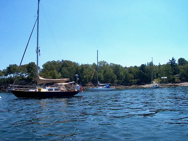
We had a cooperative dinner on Glissando, with Dasein providing fresh haddock to complement those great steaks, all of which melted in our mouths. A very pleasant evening was had by all, and we even had the humorous interlude of a visit from the folks on Rubyiat, which we had seen one week ago to the day at Pickering Island, and we had the exact same conversation with them, since they obviously did not remember us from the last time. It was really quite amusing. Friday 8/16: Smith Cove - Holbrook Island Harbor (Rhumb Line Distance: 3.56 nm) PDF Route Chart Harbor Detail Chart Today was the first day of our long-scheduled Triton rendezvous, scheduled for Holbrook Harbor. Since we were so close by, we didn't have to rush to leave, but we finally departed at around 1030 to take advantage of the outgoing tide in the cove and the river. The weather was gray with annoyingly light showers. Soon, we had arrived at Holbrook and dropped an anchor near the beach in the eastern end of the cove. Holbrook is very pretty, and huge as well, with good protection from all directions, depending on where you set the anchor. For sociability, we rafted with Dasein, planning to raft up with any and all Tritons that showed up. We were expecting at least three, including ourselves and Dasein, with possibly a couple more as well as a couple of non-Tritons that are owned by previous Triton owners and/or enthusiasts.
Saturday 8/17: Holbrook Island Harbor - Islesboro Harbor/Hewes Point (Rhumb Line Distance: 6.11 nm) PDF Route Chart Harbor Detail Chart Oh, it was supposed to be such a nice, relaxing, fun day--the second day of our rendezvous, and the lobster bake on Islesboro. Sometimes, things happen.
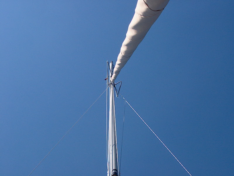
Later, another boat--a Pearson Wanderer whose owners recently purchased Triton hull # 1, L'una--arrived from Swans Island for the lobster bake, and after they tied up next to Bob Clayton's Triton (our lobster bake host) I rowed over to say hi and chat. As I did so, a wake rolled through the anchorage, and a line they had secured to their coaming snapped the coaming right off. This should have been a harbinger of things to come, but Glissando and Dasein rode it out fine. (Our masts were nicely staggered, and lots of fenders.) 10 or 15 minutes later, as I was still in the dinghy chatting with the folks on the Wanderer, I looked up in horror to see another huge wake rolling towards the sterns of our boats, rafted up nearby, and watched in amazement and disbelief as the waves fairly picked up both boats and rocked them terribly fore and aft, but slightly out of synch. Just as the thought was entering my head that this was bad, the masts hit, hard, once, twice, three or four times--a rafting nightmare, and when the wake was past there were two mangled sets of jumper struts on our boats, plus any other damage that I couldn't yet see. I rowed vigorously over to assess the damage--Heather, Nathan, and Heidi were still aboard and were also staring at the masts in disbelief.
To paraphrase Poe, "Quoth the rafters...nevermore..."; no more raft-ups for either of us. All it takes is one incident to cure that stupidness. All I could think of was our 6-boat raftup earlier in the summer, and what a disaster this wake would have been to that. I wonder if we'll ever be able to do that again? Commiserating, I pointed out Heidi's observation, at which time we noticed that their starboard spreader base had sheared from some impact during the collision; it was still under compression and doing its job, but the broken part of the base had slid aft an inch or two, and who knew how long that would last. Suddenly, things were much worse than just a set or two of jumpers. This was a problem with potentially disastrous implications, and I felt so bad for them, since of course the boat could not be sailed that way--their cruise was winding down after the rendezvous, and they were heading home, but this development would, at the least, preclude any sailing, and possibly even worse. This was a real bummer for them, and for us, too, for their sake. The immediate issue was how to stabilize their spreader so that it would at least stay the way it was. Nathan and I rowed ashore to talk to our meeting host, who was not around but we spoke with his son, Mark, who was most helpful and came right out to the boat to have a look. He shinnied up the mast and popped the spreader base back in place, then returned back up the mast in a bosun's chair to lash it in place, a decent stop-gap. As I rowed him back to shore, we discussed Glissando's problems, and finally settled on a plan where I would bring the boat around to the yard Mark worked at in Ames Cove off Gilkey Harbor, on the other side of Islesboro, the next morning at high tide, since their docks are tidal. The time was set for 0800, which would mean a pretty early departure to get there in time. Finally, we all went ashore for the festivities, to find that no one had come from shoreside, as planned (boo!), but what a fine spread was put on by the Clayton clan! Steamers, lobsters, corn, burgers, hot dogs, salad...and tons of everything. What a nice time, all things considered. Too bad none of us were too much in the mood, although we enjoyed the food! We hit the rack fairly early, since I planned to get up before 0600 so that I could motor the boat around the bottom of the island and through Brackett Channel, which on the chart looked difficult, although by now I was jaded and had seen so many channels that looked much worse on the chart than in person. But that's tomorrow's log! Please click here to continue to the log for week 6.
|
|||||||||||||
|
|||||||||||||